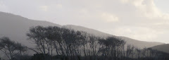
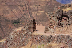
Hapuna Beach

Tuesday, August 4, 2009

A Testimonial: Altitude Counts and Oxygen Matters

The Andes


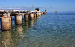
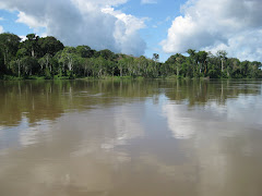
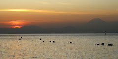
Lake Titticaca (The distant snow-capped mountains are actually in Boliva.)


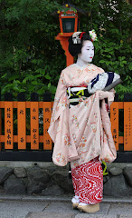
And symptoms of altitude sickness infiltrated the well-being of every single one of us on "Tour Intrepid"; the degree of severity ranged from headache and malaise all the way to such a serious shortage of oxygen content in the blood as to require the administration of supplemental oxygen at a clinic. Even our tour guide Claire, who resides in Cusco (elevation in the 11,000 ft. range), experienced the increased need to pee as we wended our way from Arequipa (8,000 ft.-ish) to Puno (12,500 ft.-ish), located on the shore of Lake Titticaca. For, you see, one loses a higher rate of water vapor from the lungs at higher altitudes, so one needs to drink more to stay hydrated, and thus, one tends to pee more as well. Headache, a common complaint of many adjusting to higher altitudes, is a symptom of both dehydration and altitude sickness, and a goodly number of those suffering headaches at altitude could be dealing with either or both issues.

Well, while in Arequipa I had a slight headache most of the time, one I explained away as a sinus situation because of the dryness of the air. Now, with hindsight and a better knowledge of altitude sickness, I suspect that my current low-lander status--afterall, I have dwelt near the coast of Tokyo Bay for four years--subjected me to initiatory symptoms of altitude sickness the two days we stayed there. Altitude sickness generally becomes operative for a statistical group of the population around 8000 feet, the elevation of Arequipa.

The morning we left Arequipa to drive to Puno, we stopped at a shop selling coca leaves and goods made from coca leaves--NOT as in "cocaine," mind you--and Claire insisted that we all purchase something made with coca leaf to consume on our days's journey, an ascent of over 4000 feet; natural coca has properties that seem to alleviate altitude sickness. (STAY TUNED: I will discuss coca and our experiences with it in my next blog post.)

By dinner time that evening in Puno, our group had lost four in number--too miserable to leave their beds, they were--and a few more felt "iffy," but Claire encouraged them to try to eat something and to continue drinking at least water. Then she confided that Puno was always the point on the tour where she temporarily "lost" tour members. By 11:00 that night misery caught up with me. For the next 5-6 hours I couldn't sleep, I peed at 90 minute intervals (and continued with that pee schedule for about the next 36 hours), at moments I felt like I couldn't catch my breath, and then I added bathroom forays to deal with the kind of stomach distress that generates the internal quandary of just what one ought to do with the commode: sit on it or lean over it with mouth wide open.

Although there were moments during the night when I fully believed I would have to forfeit the next day's activities on Lake Titticaca and moan away the day in the hotel room, by morning--even if still hovering in the below average range of wellness--I decided to give it go: My destiny might never include Lake Titticaca again! At breakfast we learned that Claire had escorted two of our group to the clinic due to more severe altitude-induced symptoms; one actually spent the rest of the night in the clinic hooked up to supplemental oxygen. Ultimately, only those two remained at the hotel and did not participate in the Lake Titticaca activities. Not that the rest of us were in real great shape by any means either, as evidenced by the fact that on the three-hour boat ride out from Puno and then back to Puno, every single one of us spent an inordinate amount of both blocks of time stretched out on the benches or on the decks sleeping! Still after our lunch on Taquille Island that day, I felt crazily SO much better; even the slight but constant headache of the last three and a half days had disappeared.

Below are listed some of most common symptoms of altitude sickness--the so-called "mild" form, not the kind that puts you in the hospital and can kill you:

Headache
Lack of appetite, nasea, or vomiting
Fatigue or weakness
Dizziness or light-headedness
Insomnia
"Pins and needles"
Shortness of breath
Rapid pulse
Drowsiness
General malaise
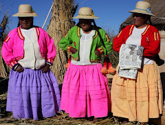
Peripheral edema (swelling of hands, feet, or face) Several in the group mentioned they couldn't get their rings off.
"Blonde" moments

And to conclude, here is a "blonde" moment story: That first night in Puno, after dinner but before the true misery of altitude sickness caught me, Carolee decided to take her shower before bed because Lake Titticaca activities included an early morning wake-up call. After her shower Carolee informed me that none of the water had drained. I investigated the situation, and sure enough, the water in the tub did not seem to be draining at all. Since I would want a shower in the morning, Carolee called reception, and they immediately sent up a handyman. He was only in the bathroom for a moment before re-emerging with a big grin on his face. In his hand he held up the plug for the tub. Carolee had not considered whether or not the tub had a plug, and that night the thought never crossed my mind either.


Monday, August 3, 2009

Designing a Desert: The Nazca Lines

Apparently deserts as canvas have intrigued the artistic mind for centuries. Near the dusty highway town of Nazca, an amazingly flat expanse of Peru's San Jose Desert is etched with geometric lines and shapes, some of which portray the stylized forms of a hummingbird, a killer whale, a monkey, and even a "space man." Enormous in scope and size--and best viewed from the air for a true appreciation of the mindset and vision to create them--these enigmatic lines have conjured a full array of theories, from clever to cracked, to explain their existence. The fact that the first ones of these "lines" date back to approximately 400BC only fuels the range of theoretical possibilities. Just take a look at these:

1. from the German mathematician Maria Reiche--originally the translator for the American archaeologist Paul Kosok, the one who first brought aerial photos of the lines to the world's newspapers in 1939--by the time she died in 1998 after studying the lines for six decades of her life - the lines were "the biggest astronomy book in the world."
2. from Hans Horkheimer (1947) - the lines were tribal symbols.
3. from George Von Breunig (1980) - the lines were a giant running track.
4. from Henri Stirlin later in the 1980s - the lines represented huge weavings and strands of yarn.
5. from Erich von Daniken in his book Chariots of the Gods - the entire area was a giant landing strip for extraterrestrials and one of the shapes was an astronaut. (See Space Man figure below.)
6. A popular current theory is that the lines were mainly about water in this arid land; the lines were created for religious/magical practices to ensure a steady supply of water.

Most of us in the Intrepid Tour chose to view the Nasca Lines the optimal way: by air. As one of five passengers in a small plane piloted by Juan Carlos, I had a wonderful time photographing the lines for the majority of the flight, although my stomach lost its steel after about the eighth set of steeply banked curves--modus operandi to allow people on both sides of the plane to see the lines. My queasiness quotient jumped exponentially, though, when the lady in the passenger seat beside Juan Carlos commenced urping into a barf bag. Seated directly behind Juan Carlos, I was the only one besides him who was aware of her actions for she was admirably discrete . . . . It's just that I had a direct view of both her and the barf bag. However, we landed without anyone else heaving, and a few minutes perambulating on stable ground and gulping in fresh air quickly quieted the nausea factor.


Up we go! The only green in this landscape is the irrigated swath on both sides of the Nazca River.


Some of the earliest lines.
(Click on any of the photos to see a larger perspective; details show up better, too.)


The killer whale--a "water figure."


Here is the Space Man; he's actually on the side of one of the few low hills.


Monkey


Hmmm . . . I'm calling it a dog.


Spider


Hummingbird


Hands . . . and for some reason I really like this one.

I photographed more forms and shapes on our flight than are included here; these are just some of my favorites.


Carolee tips Juan Carlos (wearing the white shirt) at the conclusion of our flight.

Sunday, August 2, 2009

"On the Edge" in Peru


Mary, one of my ski buddies in Germany, used to remind us whenever we contemplated attempting a more challenging slope, “If you’re not living on the edge, you’re taking up too much room.”

Near Ica, between Pisco and Nazca, the oasis of Huacachina nestles amid towering sand dunes. Exploring these dunes via dune buggy and sandboards counts as one of our "edgier" activities while on the Intrepid Tour.


All but two of our group chose to partake in this sandy adventure, and transporting us required two vehicles. Although all of us are pictured below on the monster buggy, Beth, Carolee, Liz, and I actually rode in a second and smaller buggy.

Here it is!


We watch the monster buggy plunge down a dune, and then they--from a valley location--witness ours from a different dune.
The ups and downs, the speeds and lulls, the perspectives and blind-spots, and the fluttery and dropping stomach sensations definitely reminded us of roller coaster experiences.


Now for sandboarding . . . And, by the way, all three of the dunes we sandboarded here would dwarf the dune Beth and I descended at 90-Mile Beach in New Zealand! Here our dune buggy driver instructs me on sandboard body position while sharing precautions and tips for the ultimate descent.


Oh, yes, one must remember to keep the legs spread apart.


I'm off...and the shadows in the bottom right-hand corner are Beth's hands; she documented this descent of mine.


And then a concluding photo op above the oasis before lunching at an oasis restaurant. . . . and the sand lodged in every crevice of my body remains invisible to the camera lens!


Tuesday, July 28, 2009

How Many Countries?

(I think I counted 50!)


Several days ago my friend Sondy polled Facebook friends on the number of states in the USA they had lived in and been to. (According to the survey she posted, the average number of states is only EIGHT! Okay . . . if true, that number surprises me—a lot smaller than I would have surmised.) At the end of her personal listing of states, she commented that a similar survey of countries lived in and visited ought to be submitted. Certainly such a survey could also provide a rather fascinating glimpse of people’s lives and experiences. The idea has wandered my mind for a couple of days now, and what easier time than during a teacher’s summer to set one up.

Well, . . . I have learned that merely setting up a list of the current countries in the world carries its own collection of issues. Nevertheless, I persevered: I just established myself as the final judge of whether or not a country appearing on any of the three lists I examined on the Internet could keep its position on mine, the one below. All member countries of the UN show up, but I have included a few others that remain in the realm of dispute: (a) disparate views on territory and/or autonomy (b) history and political ideology still precluding the acceptance of said entity as an independent nation. These countries I have marked with an asterisk.

Then, to keep the polling structure of this survey consistent with the one about states in the USA I completed on Facebook, I have used the same instructions: Place an X by any country visited, an O by a country lived in. So, the below list shows not only the countries of the world—according to Evelyn— but also my responses to the survey.


Countries of the World

Afghanistan
Albania
Algeria

American Samoa
Andorra
Angola
Antigua and Barbuda
Argentina
Armenia
Australia – X
Austria – X
Azerbaijan
Bahamas
Bahrain
Bangladesh
Barbados
Belarus
Belgium – X
Belize
Benin
Bhutan
Bolivia
Bosnia and Herzegovina
Botswana
Brazil
Brunei Darussalam
Bulgaria
Burkina Faso
Burundi
Cambodia – X
Cameroon

Canada – X
Cape Verde
Central African Republic
Chad
Chile
China – X
Colombia
Comoros
Congo, Democratic Republic of the (Kinshasa)
Congo, Republic of (Brazzaville)
Cook Islands
Costa Rica
Cote D’ivoire (Ivory Coast)
Croatia
Cuba
Cyprus
Czech Republic – X
Denmark – X
Djibouti
Dominica Dominican Republic
East Timor
Ecuador
Egypt – X
El Salvador
Equatorial Guinea
Eritrea
Estonia
Ethiopia
Fiji
Finland
France – O
Gabon
Gambia
Georgia
Germany – O
Ghana

Greece – X
Grenada
Guatemala
Guinea
Guinea-Bissau
Guyana
Haiti
*Holy See (Vatican) – X
Honduras
Hungary – X
Iceland
India – X
Indonesia – X
Iran
Iraq
Ireland – X
Israel – X
Italy – X
Jamaica
Japan – O
Jordan – X
Kazakhstan
Kenya – X
Kiribati
Korea, Democratic People’s Republic of (North)
Korea, Republic of(South) – X
*Republic of Kosovo
Kuwait
Kyrgyzstan
Laos – X
Latvia
Lebanon
Lesotho
Liberia
Libya
Liechtenstein – X
Lithuania
Luxembourg – X
Macedonia
Madagascar
Malawi
Malaysia – X
Maldives – X
Mali
Malta
Marshall Islands
Mauritania
Mauritius
Mexico – X
Micronesia, Federal States of
Moldova, Republic of
Monaco – X
Mongolia
Montenegro
Morocco – X
Mozambique
Myanmar
Namibia
Nauru
Nepal
Netherlands – X
New Zealand – X
Nicaragua
Niger
Nigeria
Norway
Oman
Pakistan
Palau
*Palestinian National Authority – X
Panama
Papua New Guinea
Paraguay
Peru – X
Philippines
Poland – X
Portugal – X
Qatar – X
Romania
Russia
Rwanda
Saint Kitts and Nevis
Saint Lucia
Saint Vincent and the Grenadines
Samoa
San Marino
Sao Tome and Principe
Saudi Arabia
Senegal
Serbia
Seychelles
Sierra Leone
Singapore – X
Slovakia – X
Slovenia
Solomon Islands
Somalia
South Africa
Spain – X
Sri Lanka – X
Sudan
Suriname
Swaziland
Sweden – X
Switzerland – X
Syria
*Taiwan (Republic of China)
Tajikistan
Tanzania – X
Thailand – O
Tibet
Togo
Tonga
Trinidad and Tobago
Tunisia
Turkey – X
Turkmenistan
Tuvalu
Uganda
Ukraine
United Arab Emirates – X
United Kingdom – X
United States of America – O
Uruguay
Uzbekistan
Vanuatu
Venezuela
Vietnam
Yemen
Zambia
Zimbabwe


Saturday, July 18, 2009

Three Weeks in Peru: an Overview in Photographs

On Peru's airline, LAN, Carolee and I flew from LAX to Lima. Beth flew in to Lima from Miami on American. We met at the hotel Leon de Oro in the Miraflores distsrict of Lima, the designated meeting place for our Intrepid tour group. After a meet and greet--our group of twelve + one tourguide ranged in age from thirteen to seventy, three of us from the USA, two from New Zealand, seven from Australia, and tourguide Claire from England--and then an introductory briefing, our tour officially began Sunday afternoon, June 21, in Miraflores' main square, La Plaza de Armas.


Miraflores (Lima)


From Lima, the next morning we drove to Paracas and took a boat to the Ballestas Islands, "the poor man's Gallapogas."


That afternoon we rode dune buggies and sandboarded on towering sand dunes near the oasis of Huacachina.


From the sand dunes we headed to Nazca for the night.


Then, the next morning we viewed the Nazca Lines--one of the world's most mysterious archaeological sites--by air. (The plane I rode in held a pilot and five passengers.)
This one is one of my favorites, the monkey.

And here is the hummingbird:


The following day we continue our drive down Peru's desert coastline to Puerto Inka. Here are Darci and Beth relaxing in hammocks situated above the beach.

A gorgeous beach but one cold ocean (Humboldt Current); plus, June is winter in the southern hemishpere.


The following day we continued the journey to our next destination, Arequipa; as cities go, this one tied with Iquitos as a favorite for me.


Monasterio de Santa Catalina (a nunnery, actually) in Arequip--absolutely stunning use of line, shape, color, and landscaping.


From Arequipa we turned inland toward the Andes.


Here is our first view of Lake Titticaca at the archaeological site of Sillustani just outside of Puno.


One of the floating island villages--built on reeds--in Lake Titticaca.


Taquile Island in Lake Titticaca, an island we visited where knitting is strictly a male domain and women do the spinning.


Next, Cusco:


Machu Picchu


The Sacred Valley: first Ollantaytambo, a living Inca village. Ancient ruins design two surrounding mountainsides.


The Sacred Valley: Pisac--an important farming area for the Incas. These ruins stand above the current village of Pisac down in the river valley.


A weaving village we visited in the high country above the Sacred Valley.


The Intrepid tour ended back in Lima, Sunday, July 5. That evening Carolee and I set out on our own for an Amazon adventure when we flew to Iquitos--an Amazon River town arrived at only by boat or air. The next morning we boarded a boat and then we spent four days at a lodge further down river in the Amazon jungle.

The Amazon is way muddy, astonishingly wide, and achingly beautiful.


For our last two days in Peru we returned in Iquitos.


Here's the market in Belen, a floating village now encompassed by Iquitos: